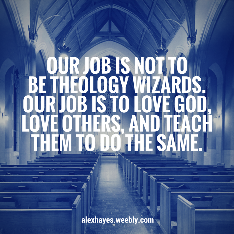
 | Lately it seems like I see more and more posts on Facebook complaining about the theology of other Christians. While a little healthy debate is normal, even encouraged, labeling someone a heretic or false prophet shouldn't be done lightly, especially on a public forum like Facebook. I would love to meet two people who have read the Bible cover-to-cover and interpreted it exactly the same way. Methodist founder John Wesley knew that we wouldn't always agree when it came to theology. That's why Wesley taught that the tenets of our faith should be filtered through four different lenses: Experience, Tradition, Reason, and most importantly Scripture. Each person who reads the Bible does so with their own blend of life experiences, religious traditions, and unique way of thinking. Is it any surprise that we don't always end up with the exact same ideas about theology? |
I am so thankful to work for a church that allows me to take time away and learn about how to be more effective at my job! Last week I attended the Center For Church Communication's Certification Lab in Dallas, TX. The lab is a 2-day intensive study into the latest trends and strategies in the field of Church Communications.
I hear it all the time. If God is good, why is there so much suffering in the world? If God is all powerful, why doesn’t He do something? The short answer is He did. When God created us, He gifted us with something so powerful, so revolutionary, it would change the way we relate as humans to God forever. It’s called free will. Why are we here? What is our life about? Lets be honest… We have all asked the question at some point. Most of us probably more than once. But when it comes to the purpose of our lives, I think a lot of us may have the wrong idea. I think most people get confused when it comes to life’s purpose because they try to look at it from the wrong perspective. It’s natural to want to think our lives are all about us. We all have dreams, hopes, desires.. It’s easy to see how our whole world can be consumed by chasing after what we want for our lives, instead of seeking after God’s plan for us.
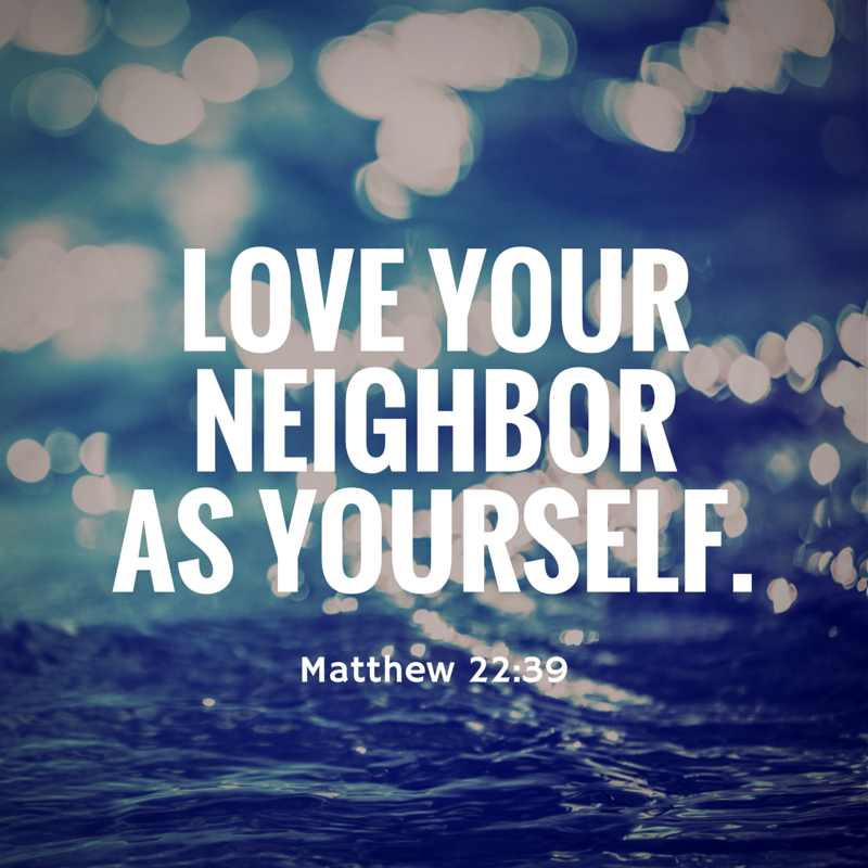
You’ve probably heard the verse at least some point in your life. "Do not judge, or you too will be judged." Matthew 7:1. But as Christians, all too often I think we forget it exists, completely. I heard a story today about a Kentucky church that decided to cut ties with the Boy Scouts. As you probably can guess, the decision was made after the Scouts recently voted to allow gay members. The Pastor of that church told WDRB, that his church “did not desire to get caught up in the new direction of the Boy Scouts.” There was another story recently on the news, about a NFL player whose speaking engagement with a church was cancelled after he openly supported Jason Collins, one of the first NBA athletes to come out about his sexuality (read the full story on USA Today). Honestly, stories like this break my heart. Because when it comes down to it… It’s the exact opposite approach a true Christian church should take.
The enemy’s greatest goal, is to keep you from reaching the full potential that God has planned for your life.
Therefore, if you want a sneak peak as to what God made you for, try examining how the enemy attacks your spirit. Often times the lies we believe about ourselves; that we’re not worthy, we’re not good enough, we’re too shy, we’re no good at public speaking, are simply falsehoods meant to keep us from searching out those areas of our personality. In order to realize the destiny that God has planned for you, you must first let go of the lies you have always believed to be “part of your personality.” Why would you chose to listen to what the evil one says about you? When you have the option of listening to what the God who created you, and knows every hair on your head, says about you? 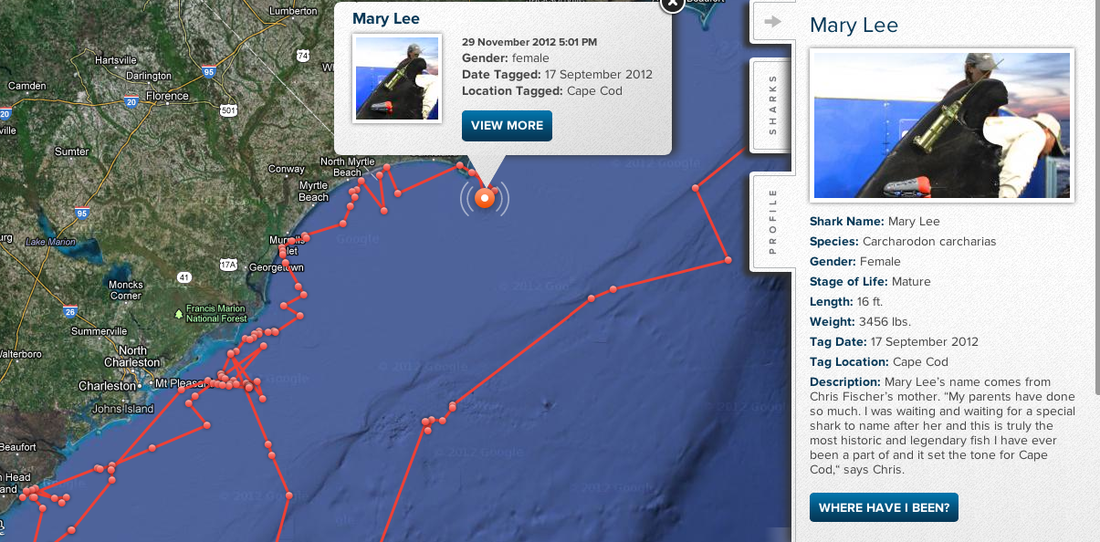 Let's take a break from the near freezing temperatures today... and set our minds on the beach! I have to say although I wasn't surprised that it exists... just shocked that I hadn't found it before now! Yes. This is exactly what it says... an online way for you track, in real time, the ocean's most feared predator... sharks! For the avid shark fan, it's an amazing tool. For the beach frequenting vacationer, it might get your blood pumping a little harder the next time you're ready to head into the surf. Just remember. We've always known sharks, BIG ones, were out there. They've been rooming the oceans for millions of years. Just because we can see where some of them are, doesn't mean they're any more likely to bite. In one year in the U.S., sharks injured just 13 people while nearly 200,000 were hurt in accidents involving ladders, toilets and chainsaws. - Michael Reilly, Discovery There's a really good reason you should move indoors when the weather turns sour. Remember, lightning doesn't have to strike the same place twice for you to get in trouble. One strike is enough to send you to the hospital, with potentially fatal consequences.
Jesus said, "I am the light of the world. Whoever follows me will never walk in darkness, but will have the light of life." - John 8:12
I feel like a lot of people read this passage and think, because they have a relationship with Jesus, they’re excused from the troubles of the world. But I don’t think that is quite what He is saying. Look closer than the surface… Jesus didn’t say there wouldn't be darkness. He doesn’t say once you join Him, the darkness goes away. What He is actually saying is so much more powerful than that. He said through the darkness, if you walk with Him, you will be shielded in His light. Because we have Him, it’s like we have a flashlight that will never run out of batteries. Because He is the light of the world, His glory, love, magnificence… it covers you, no matter what else is going on around you. No matter how dark the situation seems, you will always have a light to see Truth. Because God is truly always with you. "I have told you these things, so that in me you may have peace. In this world you will have trouble. But take heart! I have overcome the world.” - John 16:33 Why would God send His son to die for us in order to redeem us, only to stand at a distance?
God wants to be close to you! He wants an intimate relationship with you. He didn’t pay the ultimate costs so you could live a mediocre life. “I know the plans I have for you declares the Lord, plans to prosper you and not to harm you, plans to give you hope and a future.” Jeremiah 29:11 God loves us so much, He came down to live among us, not to show off His power and glory by reigning over us in might, but instead, He came as a servant (Matthew 20:28). But more than that, God isn’t waiting until the day we die and ascend into Heaven to be with us. He desires to be with us daily. Jesus himself says in John 17:24 "Father, I want those you have given me to be with me." Not just in Heaven, but here on Earth. If you have any doubt about that fact, starting your own personal study of the Song of Solomon. Picture the relationship that is depicted within those 8 chapters as a blue print for your relationship with God. |


 RSS Feed
